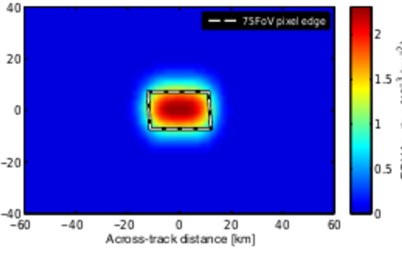
This paper presents an independent, simple and robust method to retrieve the FOV of an instrument during operation, i.e. the two-dimensional sensitivity distribution, sampled on a discrete grid. The method relies on correlated measurements featuring a significantly higher spatial resolution, e.g. by an imaging instrument accompanying a spectrometer. The method was applied to two satellite instruments, GOME-2 and OMI, and a ground-based differential optical absorption spectroscopy (DOAS) instrument integrated in an SO2 camera. For GOME-2, quadrangular FOVs could be retrieved, which almost perfectly match the provided FOV edges after applying a correction for spatial aliasing inherent to GOME-type instruments. More complex sensitivity distributions were found at certain scanner angles, which are probably caused by degradation of the moving parts within the instrument. For OMI, which does not feature any moving parts, retrieved sensitivity distributions were much smoother compared to GOME-2. A 2-D super-Gaussian with six parameters was found to be an appropriate model to describe the retrieved OMI FOV. The comparison with operationally provided FOV dimensions revealed small differences, which could be mostly explained by the limitations of our IFR implementation. For the ground-based DOAS instrument, the FOV retrieved using SO2-camera data was slightly smaller than the flat-disc distribution, which is assumed by the state-of-the-art correlation technique. Differences between both methods may be attributed to spatial inhomogeneities.
In general, our results confirm the already deduced FOV distributions of OMI, GOME-2, and the ground-based DOAS. It is certainly applicable for degradation monitoring and verification exercises. For satellite instruments, the gained information is expected to increase the accuracy of combined products, where measurements of different instruments are integrated, e.g. mapping of high-resolution cloud information, incorporation of surface climatologies. For the SO2-camera community, the method presents a new and efficient tool to monitor the DOAS FOV in the field.
H Sihler, P Lübcke, R Lang, S Beirle, M de Graaf, C Hörmann, J Lampel, M Penning de Vries, J Remmers, E Trollope, Y Wang. In-operation field-of-view retrieval (IFR) for satellite and ground-based DOAS-type instruments applying coincident high-resolution imager data
Status: published, Journal: Atmospheric Measurement Techniques, Volume: 10, Year: 2017, First page: 881, Last page: 903, doi: 10.5194/amt-10-881-2017